|
|
| Post Number: 1
|
ICU812 

Group: Super Administrators
Posts: 3244
Joined: Aug. 2003
|
 |
Posted on: Jul. 20 2005,1:05 pm |
|
   |
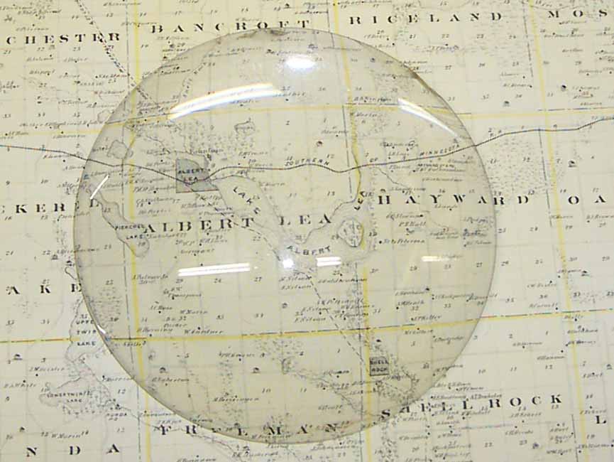
Bought a map of Freeborn County from 1874. I was looking at it and noticed that Albert Lea Lake had an island on it. Anyone know of such a thing?
Really a neat map if you are into things like that. If anyone wants close-ups of it let me know.
Also a map of Albert Lea on the reverse side.
Attached Image
|
 |
|
|
| Post Number: 2
|
ICU812
Group: Super Administrators
Posts: 3244
Joined: Aug. 2003
|
|
Posted on: Jul. 20 2005,1:10 pm |
|
 |
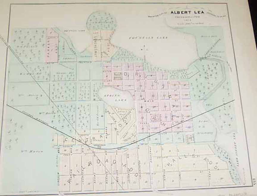
1874 Albert Lea
Attached Image
|
|
|
|
| Post Number: 3
|
The Coach

Group: Members
Posts: 169
Joined: Feb. 2005
|
|
Posted on: Jul. 20 2005,1:36 pm |
|
|
That would be Big Island, as in Big Island State Park. Really was an island once.
--------------
I'm The Coach, but don't call me.
|
|
|
|
| Post Number: 4
|
ICU812
Group: Super Administrators
Posts: 3244
Joined: Aug. 2003
|
|
Posted on: Jul. 20 2005,1:39 pm |
|
|
Didn't even dawn on me 
Wish I would have looked at it a little longer before asking that one
|
|
|
|
| Post Number: 5
|
Replicant

Group: Members
Posts: 1570
Joined: Dec. 2004
|
|
Posted on: Jul. 20 2005,11:18 pm |
|
|
Cool map, I share your interest in local history and obtaining things like these maps and pictures. Another EBay purchase?
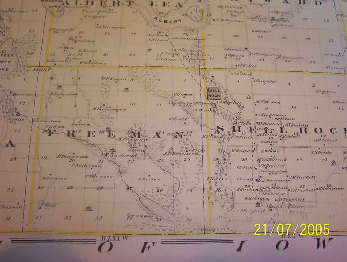
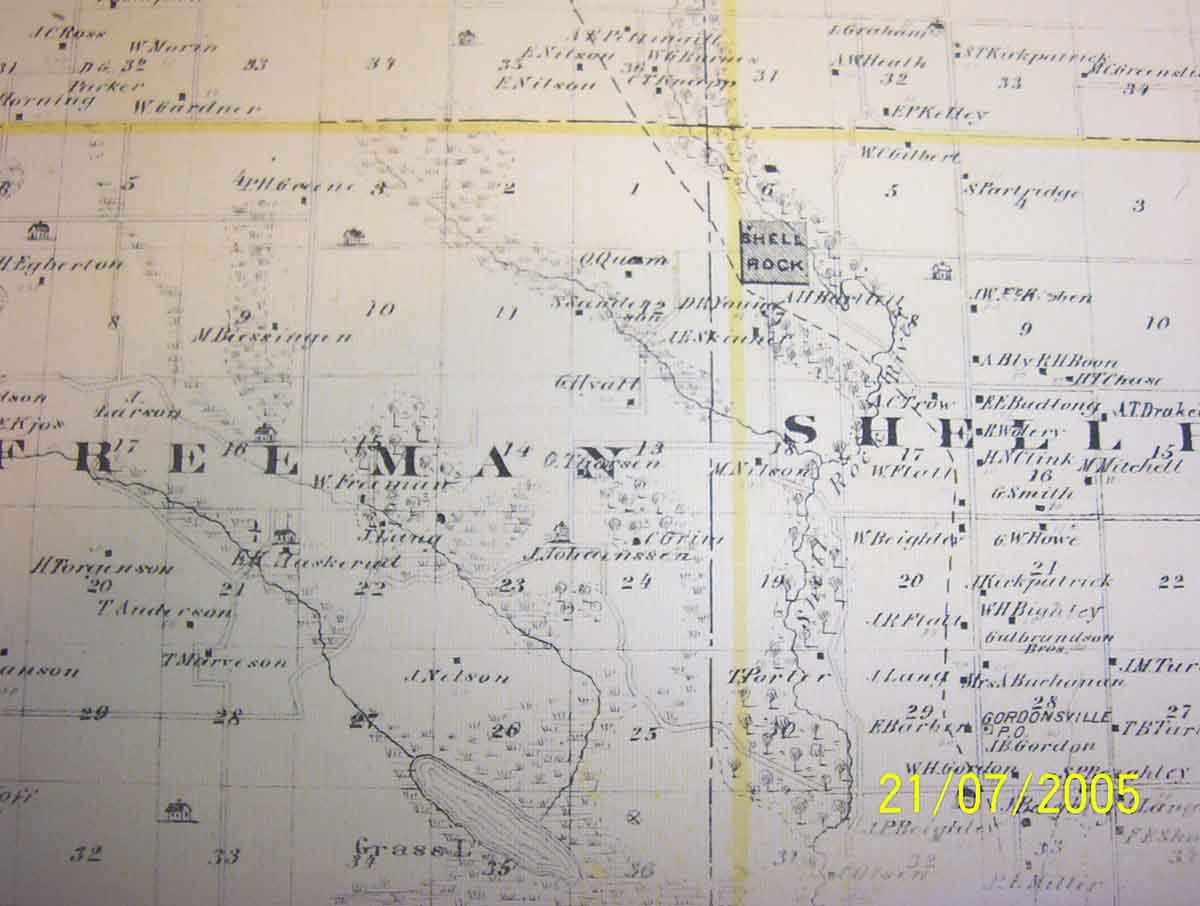
Could you post a closeup of the area between Albert Lea & Glenville? Four corner area of Albert Lea, Freeman, Shell Rock & Hayward townships). Particularly the area around the dashed line (railroad line I'm assuming) between AL Lake and Glenville (still called Shell Rock then).
Thanks for sharing...
--------------
Some drink deeply from the river of knowledge. Others only gargle. - Woody Allen
The problem is not that we have too many fools, it's that the lightning isn't distributed right. - Mark Twain.
|
|
|
|
| Post Number: 6
|
ICU812
Group: Super Administrators
Posts: 3244
Joined: Aug. 2003
|
|
Posted on: Jul. 21 2005,7:58 pm |
|
|
Here you go
Attached Image
|
|
|
|
| Post Number: 7
|
ICU812
Group: Super Administrators
Posts: 3244
Joined: Aug. 2003
|
|
Posted on: Jul. 21 2005,7:59 pm |
|
|
and one more. dont know how they look, my monitor at home is in need of replacing.
Attached Image
|
|
|
|
| Post Number: 8
|
|
|
| Post Number: 9
|
gabby05

Group: Members
Posts: 155
Joined: Sep. 2005
|
|
Posted on: Nov. 03 2005,11:32 pm |
|
|
Another interesting place to look at. Freeborn County Historical book. I am amazed at all the businesses we had here. The people that came just to start businesses here. I have found a couple of distant relatives. There are maps and explanations of each township, beginnings. I'm sure many of you have seen. I am just discovering it. Fascinating:D 
|
|
|
|
| Post Number: 10
|
jimhanson

Group: Moderator
Posts: 8491
Joined: Aug. 2003
|
|
Posted on: Nov. 04 2005,11:57 am |
|
|
ICU812--compare the 1874 map with Lea's map. Lea drew out the contours of the lake, but didn't show an island in the lake. Thinking about it, without the dam (and the increased lake water level), the present "island" would not have been an island at all, but a part of the north shore peninsula.
--------------
"If you want to anger a Conservative, tell him a lie. If you want to anger a LIBERAL, tell him the TRUTH!"
|
|
|
|
|
|


